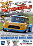
| Title: | Course de côte Miribel-Lanchâtre |
| Place: | Miribel-Lanchâtre |
| Tracklength: | 1500 metres |
| Elevation change: | 115 metres |
| Altitude finishline: | 880 metres |
| GPS coordinates: | 44° 58′ 22.7994″ – 5° 37′ 12″ |
| Website: | www.asadauphinoise.com |
| Fastest Time: | 0:59,005 |
| Average Speed: | 91,52 km/h |
Is there missing or incorrect information on this page? Please let me know in the comments below, or send me an email.
| Date | Winner | Car | Time | Final | |
|---|---|---|---|---|---|
| 29/04/2001 | Bernard Olivier |  | Martini MK49/56 | 1:01,68 | Results |
| 28/04/2002 | Gérald Antiochia |  | Martini MK62 | 2:03,86 | Results |
| 27/04/2003 | Stéphane Damnon |  | March 82 DDS | 1:01,61 | Results |
| 25/04/2004 | Stéphane Damnon |  | March 82 DDS | 1:02,83 | Results |
| 24/04/2005 | Gérald Antiochia |  | Martini MK62 | 1:03,08 | Results |
| 29/04/2007 | Nicolas Schatz |  | Dallara 389 | 1:00,560 | Results |
| 27/04/2008 | Pierre Vonic |  | Duqueine F2 | 0:59,491 | Results |
| 26/04/2009 | Marcel Sapin |  | Martini MK80 | 1:05,559 | Results |
| 25/04/2010 | Marcel Sapin |  | Dallara F301 | 0:59,768 | Results |
| 08/05/2011 | Marcel Sapin |  | Dallara F301 | 0:59,005 | Results |
| 29/04/2012 | Laurent Guittonneau |  | Dallara F399 | 1:00,155 | Results |
| 28/04/2013 | Laurent Guittonneau |  | Dallara F399 | 1:07,153 | Results |
| 04/05/2014 | Marcel Sapin |  | Mygale F3 | 0:59,851 | Results |
Miribel-Lanchâtre is a small hamlet in the Rhône-Alpes region. It is situated some 30 kilometres south of Grenoble. The town is located on the eastern slopes of the Massif du Vercors, in English also known as the Vercors Plateau. The term plateau is used here because the mountain range has a large elevation difference with the surrounding valleys. Indeed Miribel-Lanchâtre is at an altitude of some 650 metres still not even halfway up the mountainside. In the heart of the Plateau the mountains are cut by very deep gorges. This is a result of the karst surface that is prone ot erosion. For the same reason the Vercors Plateau has one of the largest cave systems in Europe. For a while the Gouffre Berger Cave near Engins was considered the deepest cave in the world at -1150 metres. For those that are not so well trained in spelunking there are also caves more suited for tourists, like the Grottes de Choranche. The Plateau de Vercors is protected in a large nature reservation.
The steep slopes make the Vercors Plateau one of the most isolated parts of France. It was only until the 20th century any roads were build in the area. It makes driving a beautiful but very dangerous experience.
That the Vercors Plateau was uninhabited and difficult to traverse also made it the ideal place for resistance fighters. In the Second World War the region was the centre of French Resistance against the German occupiers. The partisans, also called the Maquis du Vercors, directly confronted the German troops in July 1944 but were put down in a bloody battle. The region is scattered with memorials dedicated to the resistance.

